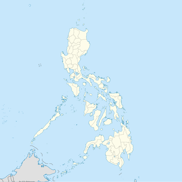
Beureukaih:Philippines location map (square).svg

Ukuran pratayang PNG ini dari berkas SVG ini: 600 × 600 piksel Resolusi la'én: 240 × 240 piksel | 480 × 480 piksel | 768 × 768 piksel | 1.024 × 1.024 piksel | 2.048 × 2.048 piksel | 1.332 × 1.332 piksel.
Beureukaih aseuli (Beureukah SVG, nominal 1.332 x 1.332 piksel, rayek beureukah: 1,49 MB)
Riwayat beureukaih
Neuteugon bak uroe buleuen/watèe keu neu-eu beureukaih nyoe ‘oh watèe nyan.
| Uroe buleuen/Watèe | Beuntuk ubeut | Dimènsi | Ureueng ngui | Beunalaih | |
|---|---|---|---|---|---|
| jinoë hat | 19 Buleuen Lapan 2021 17.17 |  | 1.332 × 1.332 (1,49 MB) | AichiWikiFixer | Updated boundaries |
| 18 Buleuen Nam 2021 14.53 |  | 1.332 × 1.332 (2,24 MB) | AichiWikiFixer | Map update. | |
| 18 Buleuen Nam 2021 10.55 |  | 1.332 × 1.332 (2,23 MB) | AichiWikiFixer | Small changes. | |
| 18 Buleuen Nam 2021 10.49 |  | 1.332 × 1.332 (2,23 MB) | AichiWikiFixer | External changes for boundaries and coastlines. | |
| 17 Buleuen Nam 2021 20.11 |  | 1.332 × 1.332 (2,23 MB) | AichiWikiFixer | Additional islands, lakes, and updated coastlines. | |
| 17 Buleuen Nam 2021 17.34 |  | 1.332 × 1.332 (2,23 MB) | AichiWikiFixer | Update boundaries. | |
| 25 Buleuen Limöng 2021 09.04 |  | 1.332 × 1.332 (2,22 MB) | HueMan1 | Reverted to version as of 07:24, 7 September 2020 (UTC) | |
| 17 Buleuen Limöng 2021 14.11 |  | 1.332 × 1.332 (3,72 MB) | Petriolo | Reverted to version as of 05:36, 3 May 2021 (UTC) The new administrative borders are based from the Philippine government websites (https://www.geoportal.gov.ph/; http://noah.up.edu.ph/), and is deemed accurate. These new files have reliable sources and there's no "beauty" in it if it is inaccurate in the first place. | |
| 16 Buleuen Limöng 2021 21.00 |  | 1.332 × 1.332 (2,22 MB) | AichiWikiFixer | Reverted to version as of 07:24, 7 September 2020 (UTC) (Borders seen as ugly) | |
| 3 Buleuen Limöng 2021 12.36 |  | 1.332 × 1.332 (3,72 MB) | Petriolo | updated with NAMRIA borders |
Seuneungui beureukaih
Hana laman nyang na meupawôt u beureukaih nyoe.
Neungui beureukaih global
Wiki laén di yup nyoe geungui beureukaih nyoe:
- Seuneungui bak af.wikipedia.org
- Seuneungui bak ar.wikipedia.org
- Seuneungui bak arz.wikipedia.org
- Seuneungui bak ast.wikipedia.org
- Asturias (Filipines)
- Toboso
- Lucena (Filipines)
- Alcala
- Manila
- Módulu:Mapa de llocalización/datos/Filipines
- Mar de Joló
- Luzón
- Komisyon sa Wikang Filipino
- Mar de Visayas
- Mindanao
- Lingayén
- Tarlac
- Vigan
- Dávao
- Complexu del Batasang Pambansa
- Ríu Pásig
- Estrechu de Mindoro
- Estrechu de Luzón
- Islles de Calamianes
- Módulu:Mapa de llocalización/datos/Filipines/usu
- Aeropuertu Internacional Ninoy Aquino
- Pasay
- Parañaque
- Universidá de Bulacán
- Aeropuertu Daniel Z. Romuáldez
- Aeropuertu Evelio Javier
- Aeropuertu Francisco B. Reyes
- Aeropuertu Godofredo P. Ramos
- Aeropuertu d'Awang
- Aeropuertu de Bancasi
- Aeropuertu de Dipolog
- Aeropuertu d'Ipil
- Aeropuertu de Joló
- Aeropuertu de Labo
- Aeropuertu de Laguindingán
- Aeropuertu de Lumbia
- Aeropuertu de Naga
- Aeropuertu de Pagadían
- Aeropuertu de Rosales
Eu leubèh le neungui ban dum nibak beureukaih nyoe.
