
Beureukaih:Tasmania.A2005320.2355.250m.jpg

Seunipat hasé peusaneut: 480 × 600 piksel Resolusi la'én: 192 × 240 piksel | 384 × 480 piksel | 614 × 768 piksel | 819 × 1.024 piksel | 1.600 × 2.000 piksel.
Beureukaih aseuli (1.600 × 2.000 piksel, rayek beureukaih: 451 KB, MIME jeunèh: image/jpeg)
Ehtisa
| Hareutoë |
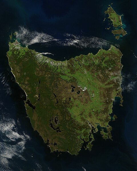
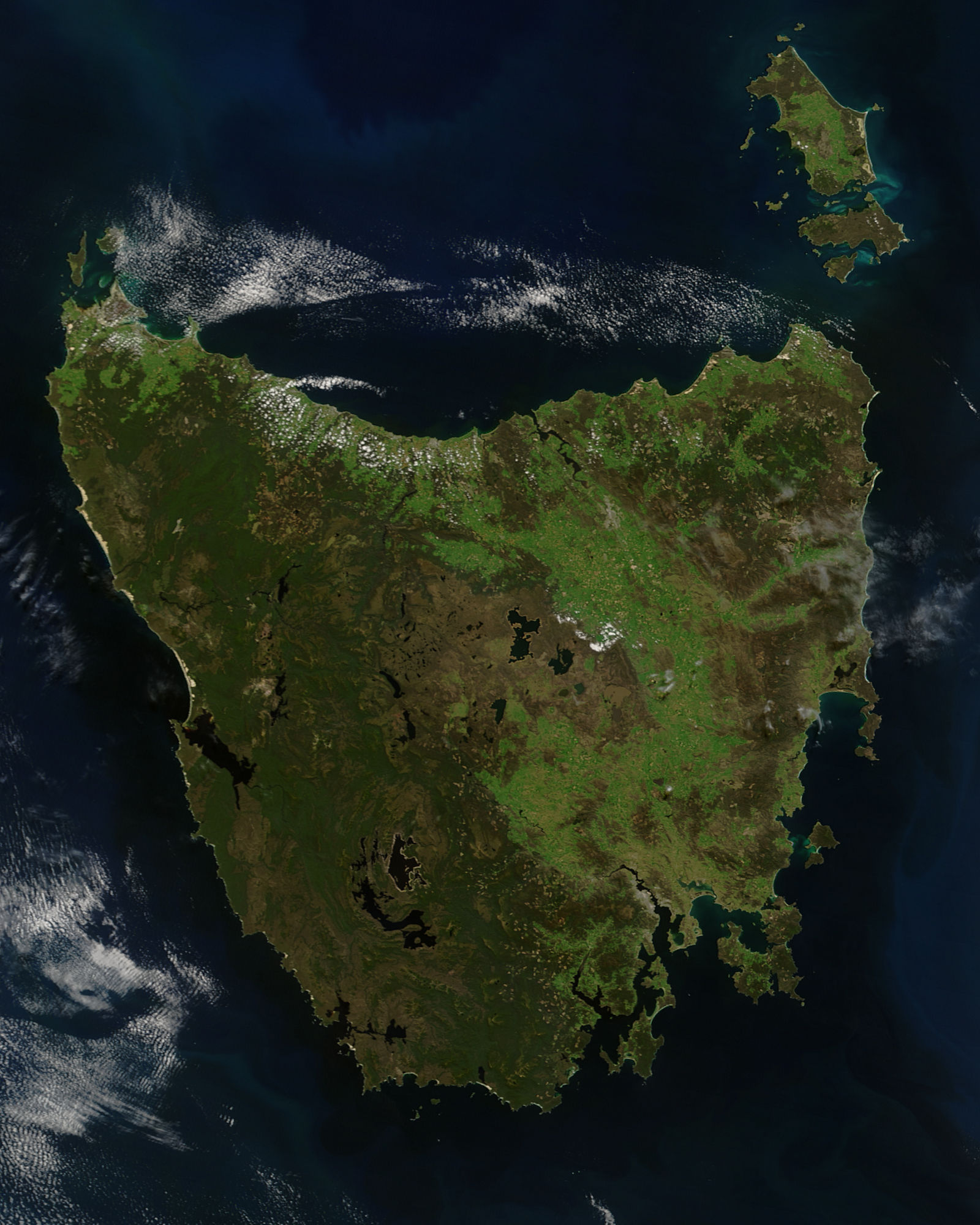
English: A true-colour satellite view of Tasmania, including Flinder's Island, taken in the spring of 2005.
Description from NASA's Visible Earth website: http://visibleearth.nasa.gov/view.php?id=74906 Tasmania was emerald green with the flush of late spring when the Moderate Resolution Imaging Spectroradiometer (MODIS) on NASA’s Terra satellite captured this image on November 16, 2005. The western half of the island is covered with dense forest, which is darker green than grasslands in the east. Sitting below 40 degrees South, the island is the only part of Australia able to support a temperate rainforest. Above the northeast corner of Tasmania are Flinders Island (top), Cape Barren Island (center), and Clarke Island (closest to Tasmania). Tasmania is thought to have been a part of mainland Australia until the end of the last ice age 10,000 years ago when sea levels rose and made Tasmania into an island. |
| Uroë buleuën | |
| Asai | http://eoimages.gsfc.nasa.gov/images/imagerecords/74000/74906/Tasmania.A2005320.2355.250m.jpg |
| Ureuëng peugöt | Jeff Schmaltz, MODIS Rapid Response Team, NASA/GSFC |
Jeunèh lisensi
| Berkas ini berada dalam domain publik di Amerika Serikat karena semata-mata diciptakan oleh NASA. Kebijakan hak cipta NASA menyatakan bahwa "materi NASA tidak dilindungi oleh hak cipta kecuali dicatat". (Lihat Template:PD-USGov, Halaman kebijakan hak cipta NASA atau JPL Image Use Policy.) | ||
 |
Peringatan:
|
Riwayat beureukaih
Neuteugon bak uroe buleuen/watèe keu neu-eu beureukaih nyoe ‘oh watèe nyan.
| Uroe buleuen/Watèe | Beuntuk ubeut | Dimènsi | Ureueng ngui | Beunalaih | |
|---|---|---|---|---|---|
| jinoë hat | 5 Buleuen Lhèe 2012 11.55 | | 1.600 × 2.000 (451 KB) | NotTarts |
Seuneungui beureukaih
laman di yup nyoe mupawôt u beureukaih nyoe:
Neungui beureukaih global
Wiki laén di yup nyoe geungui beureukaih nyoe:
- Seuneungui bak af.wikipedia.org
- Seuneungui bak bn.wikipedia.org
- Seuneungui bak ckb.wikipedia.org
- Seuneungui bak en.wikipedia.org
- Seuneungui bak es.wikipedia.org
- Seuneungui bak hu.wikipedia.org
- Seuneungui bak it.wikipedia.org
- Seuneungui bak kk.wikipedia.org
- Seuneungui bak lmo.wikipedia.org
- Seuneungui bak ml.wikipedia.org
- Seuneungui bak pa.wikipedia.org
- Seuneungui bak pl.wikipedia.org
- Seuneungui bak pt.wikipedia.org
- Seuneungui bak sd.wikipedia.org
- Seuneungui bak sr.wikipedia.org
- Seuneungui bak zh-yue.wikipedia.org