
Beureukaih:LocationCentralMiddleAfrica.png
Hana resolusi nyang leubèh manyang.
LocationCentralMiddleAfrica.png (360 × 392 piksel, rayek beureukaih: 11 KB, MIME jeunèh: image/png)
Ehtisa
| Hareutoë |
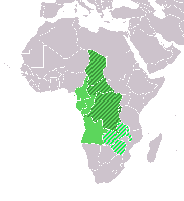
Map: Africa – Central/Middle Africa
|
| Uroë buleuën | 4 Buleuen Duwa 2006 (original upload date) |
| Asai | No machine-readable source provided. Own work assumed (based on copyright claims). |
| Ureuëng peugöt | No machine-readable author provided. E Pluribus Anthony~commonswiki assumed (based on copyright claims). |
Jeunèh lisensi
| Saya, pemegang hak cipta karya ini, merilis karya ini ke domain umum. Lisensi ini berlaku di seluruh dunia. Di sejumlah negara, tindakan ini tidak memungkinkan secara sah; bila seperti itu: Saya memberikan siapa pun hak untuk menggunakan karya ini untuk tujuan apa pun, tanpa persyaratan apa pun, kecuali yang ditetapkan oleh hukum. |
Riwayat beureukaih
Neuteugon bak uroe buleuen/watèe keu neu-eu beureukaih nyoe ‘oh watèe nyan.
| Uroe buleuen/Watèe | Beuntuk ubeut | Dimènsi | Ureueng ngui | Beunalaih | |
|---|---|---|---|---|---|
| jinoë hat | 18 Buleuen Lhèe 2018 01.13 | | 360 × 392 (11 KB) | Maphobbyist | Upload |
| 10 Buleuen Tujôh 2011 04.01 |  | 360 × 392 (14 KB) | Maphobbyist | South Sudan has become independent on July 9, 2011. Sudan and South Sudan are shown with the new international border between them. | |
| 11 Buleuen Duwa Blah 2007 15.35 |  | 360 × 392 (14 KB) | Hoshie | added Cabinda and Montenegro | |
| 30 Buleuen Duwa Blah 2006 21.04 |  | 360 × 392 (9 KB) | Henrygb~commonswiki | Reverted to earlier revision | |
| 1 Buleuen Peuet 2006 13.01 |  | 360 × 392 (14 KB) | Aris Katsaris | cleaner map -- no need to include defunct federation which confuses the map's purpose. | |
| 5 Buleuen Duwa 2006 00.40 |  | 360 × 392 (9 KB) | E Pluribus Anthony~commonswiki | Map: Central/Middle Africa (location) |
Seuneungui beureukaih
laman di yup nyoe mupawôt u beureukaih nyoe:
Neungui beureukaih global
Wiki laén di yup nyoe geungui beureukaih nyoe:
- Seuneungui bak af.wikipedia.org
- Seuneungui bak als.wikipedia.org
- Seuneungui bak am.wikipedia.org
- Seuneungui bak ar.wikipedia.org
- ليبيا
- جيبوتي
- موريتانيا
- تونس
- السودان
- الصحراء الغربية
- أنغولا
- أوغندا
- إسبانيا
- تشاد
- النيجر
- مالي
- السنغال
- غامبيا
- غينيا بيساو
- غينيا
- سيراليون
- ليبيريا
- غانا
- توغو
- بنين
- بوركينا فاسو
- الصومال
- كينيا
- تنزانيا
- الغابون
- زامبيا
- موزمبيق
- زيمبابوي
- البرتغال
- الكاميرون
- جمهورية الكونغو الديمقراطية
- بوتسوانا
- جنوب إفريقيا
- جمهورية إفريقيا الوسطى
- جمهورية الكونغو
- سيشل
- ناميبيا
- مدغشقر
- ليسوتو
- موريشيوس
- نهر النيل
- تاريخ ليبيا القديم
- نهر النيجر
Eu leubèh le neungui ban dum nibak beureukaih nyoe.