
Beureukaih:Japan bluemarble location map with side map of the Ryukyu Islands.jpg
Seunipat hasé peusaneut: 664 × 600 piksel Resolusi la'én: 266 × 240 piksel | 531 × 480 piksel | 850 × 768 piksel | 1.133 × 1.024 piksel | 2.497 × 2.256 piksel.
Beureukaih aseuli (2.497 × 2.256 piksel, rayek beureukaih: 1,38 MB, MIME jeunèh: image/jpeg)
Ehtisa
| Hareutoë |
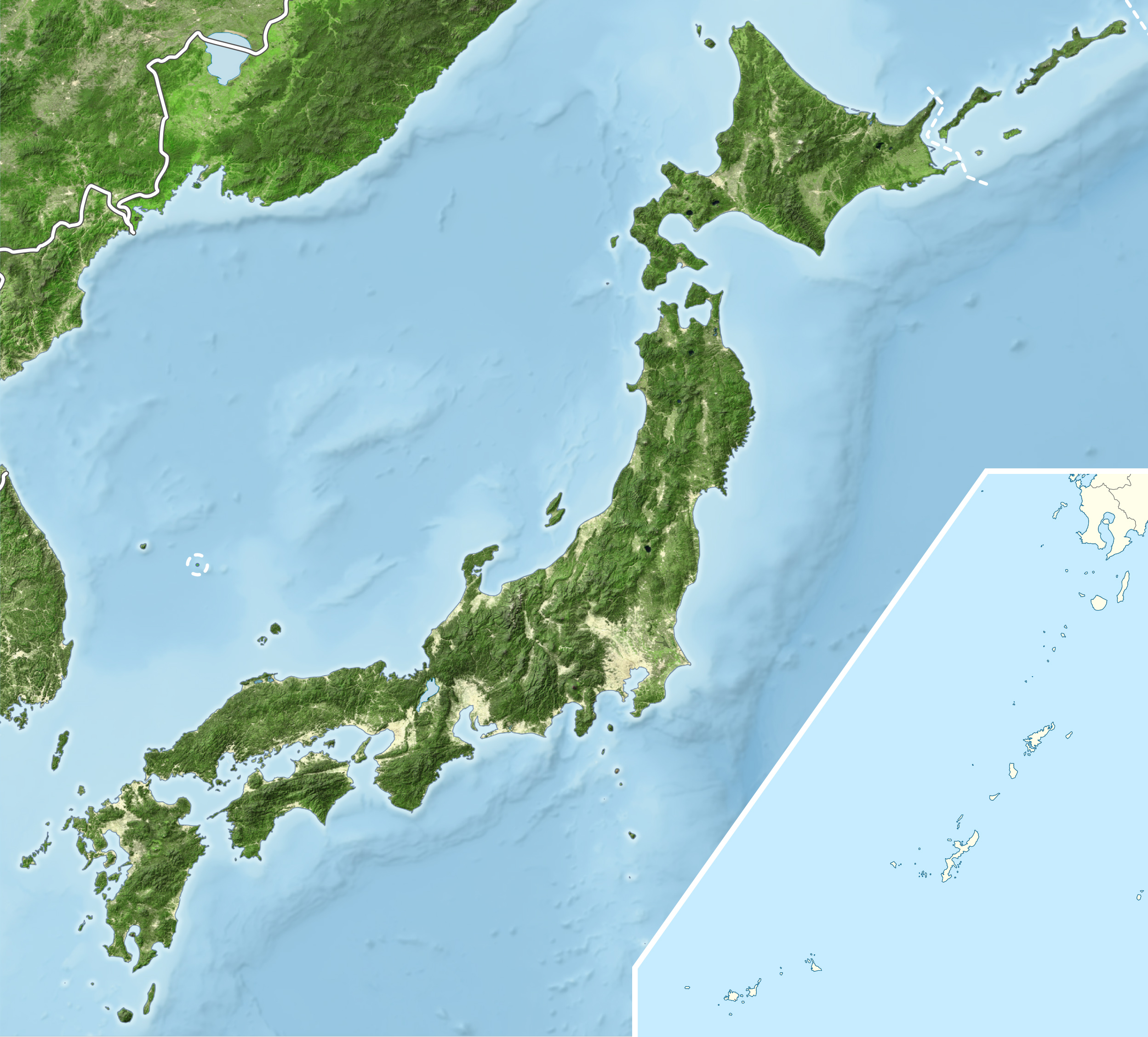
English: Blue Marble Location map of Japan
Equirectangular projection. Geographic limits to locate objects in the main map with the main islands:
Geographic limits to locate objects in the side map with the Ryukyu Islands:
|
||
| Uroë buleuën | |||
| Asai |
|
||
| Ureuëng peugöt | Alexrk2 | ||
| Idin (Ngui lom beureukaih nyoe) |
beureukaih nyoe geulisènsi ngön lisènsi Creative Commons Attribution-Share Alike 3.0 Unported.
|
||
| Versi lainnya |
|


Riwayat beureukaih
Neuteugon bak uroe buleuen/watèe keu neu-eu beureukaih nyoe ‘oh watèe nyan.
| Uroe buleuen/Watèe | Beuntuk ubeut | Dimènsi | Ureueng ngui | Beunalaih | |
|---|---|---|---|---|---|
| jinoë hat | 23 Buleuen Lhèe 2011 02.55 | | 2.497 × 2.256 (1,38 MB) | Alexrk2 | RGB |
| 23 Buleuen Lhèe 2011 02.07 |  | 2.497 × 2.256 (878 KB) | Chumwa | RGB mode | |
| 22 Buleuen Lhèe 2011 04.57 |  | 2.497 × 2.256 (1,88 MB) | Alexrk2 | jpg quality | |
| 22 Buleuen Lhèe 2011 04.05 |  | 2.497 × 2.256 (1,82 MB) | Alexrk2 | == {{int:filedesc}} == {{Information |Description= {{en|Blue Marble Location map of Japan Equirectangular projection. Geographic limits to locate objects in the main map with the main islands: * N: 45°51'37" N (45.86°N) * S: 30°01'13" N |
Seuneungui beureukaih
laman di yup nyoe mupawôt u beureukaih nyoe:
Neungui beureukaih global
Wiki laén di yup nyoe geungui beureukaih nyoe:
- Seuneungui bak ar.wikipedia.org
- Seuneungui bak arz.wikipedia.org
- Seuneungui bak ast.wikipedia.org
- Seuneungui bak as.wikipedia.org
- Seuneungui bak azb.wikipedia.org
- Seuneungui bak ban.wikipedia.org
- Seuneungui bak bcl.wikipedia.org
- Seuneungui bak bh.wikipedia.org
- Seuneungui bak bn.wikipedia.org
- Seuneungui bak br.wikipedia.org
- Seuneungui bak bs.wikipedia.org
- Seuneungui bak ca.wikipedia.org
- Seuneungui bak ceb.wikipedia.org
- Seuneungui bak ckb.wikipedia.org
- Seuneungui bak cs.wikipedia.org
- Seuneungui bak da.wikipedia.org
- Seuneungui bak de.wikipedia.org
- Seuneungui bak diq.wikipedia.org
- Seuneungui bak dty.wikipedia.org
- Seuneungui bak el.wikipedia.org
Eu leubèh le neungui ban dum nibak beureukaih nyoe.